Saturday, May 22, 2010

Springer Mountain to Unicoi Gap, Georgia

May 3-6, 2010
Southern Terminus of the AT - Springer Mountain, GA to Unicoi Gap, GA 

50.9 miles hiked this section, over 4 days
102.1 total AT miles hiked

Hikers - Jason and Kyle (broseph-in-law) aka Alien Snorer (aka Alien) and Tiptoe

Click here for pics from this section hike

Sunday, May 2nd
Milford, MI to Helen, GA - 676 miles

12 hours, Michigan to Georgia.  That's a lot of ipod tunes, politics talk and imitation southern accents.  Our destination?  Helen, Georgia in northern Georgia.  We drive 12 hours and find the Frankenmuth of Georgia?  No joke...check it out.  To preserve tradition, we bar hopped and met the locals.

Lessons learned:
1) lose the imitation southern accent while actually in the South
2) drinking too much the night before a big hike is not smart
3) do not order the the Black Pearl beer special (Natty Light) at the Black Pearl bar.

So after a night of partying, our planned 5-day hike begins.

Monday, May 3rd
Springer Mountain to Hawk Mountain Shelter - 7.8 miles + 0.9 miles up Springer Mountain from Forest Service Road 42 parking lot
We awoke to rain, but it looked like it will burn off my mid-day.  We dropped our car off at the road/trail crossing at Unicoi Gap, 50.9 miles up the trail from Springer Mountain, our starting point.  At 11:00am our shuttle driver, Bill, showed up and the hour and half drive to Springer Mountain started.  The last 10 miles of the drive up Springer are on a Forest Service road which is only maintained at the leisure of the U.S. Forest Service (so not often).  Add to that, Bill's car, is a mid-1990's Saturn Wagon.  Ground clearance?  Not so much.  To my surprise, Bill didn't even flinch when we bottomed out.  Drivetrain, optional.  I think Kyle was sleeping or at least fighting car sickness...see #3 above for pre-hiking lessons learned.


We finally made it to the top of Springer, well not really.  The way it works is the road reaches a parking lot and then you have to hike south 0.9 miles to the peak of Springer Mountain.  Then you re-trace your steps back to the parking lot and continue the hike north.

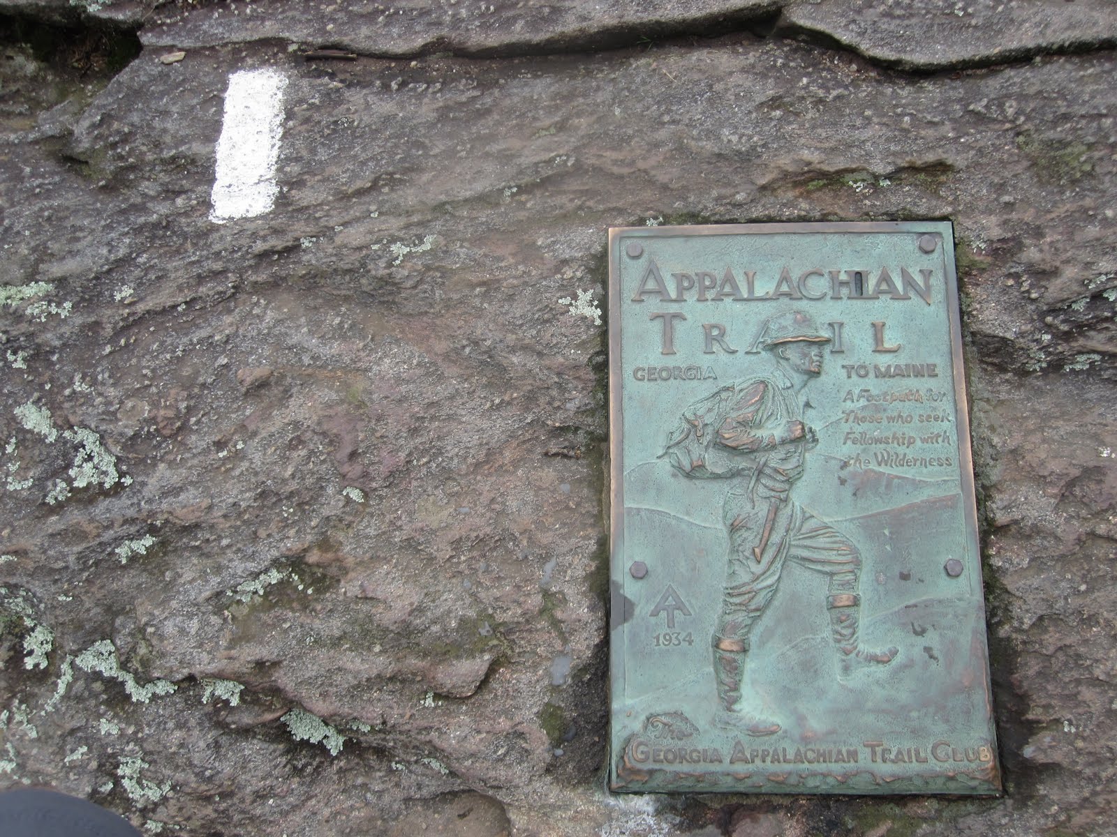
The hike up Springer went quickly.  This was historic moment for me, to actually be on the summit of Springer Mountain at the first white blaze of the Appalachian Trail.  Memories of hiking trips on the AT with my Dad filled my head.  Unfortunately we didn't get any views due to the rain and fog, but seeing the plaque and first white blaze was incredible.


After re-tracing our steps back down to the parking lot, we meet our first hikers of the trip.  A water-logged female thru-hiker and equally soggy brothers with their dogs on a 2-week hike north of the Smokies.  They told tales of the previous night's torrential rains that they endured in their tents on Springer Mountain.  It's true, tents can act as bathtubs in heavy rain.

The first half of our hike today is a gradual down slope, so all-in-all an easy first day.  We did take a short blue-blaze trail (blue blaze trails are side trails off the AT) to Long Creek Falls, which was well worth it.


Our destination for the first night is at milepoint 7.8, Hawk Mountain Shelter.  The shelter is occupied with around 6-7 hikers with another 8-10 tenting near the shelter.  We elect to tent behind the shelter...perhaps now is a good time to explain my trail name - Alien Snorer.  Ok, I snore.  Add to that a night of having a nasty cold and over-dosage of Nyquil and add the Alien part.  Thanks Kyle for my trail name!  Kyle's trail name is Tiptoe.  Long story.


Tuesday, May 4th
Hawk Mountain Shelter to Woody Gap (stayed at The Hiker Hostel ) - 12.3 miles today 
I actually slept pretty well, which I usually do not do on the first night of a hike.  After packing up (always takes longer than it should), getting water, treating water, eating breakfast, visiting the privy, putting on least smelly clothing, we start our planned 12.3 mile hike to Woody Gap.  Up first was a nice 650 foot climb over a mile up Sassafras Mountain.  Our first views of the trip!


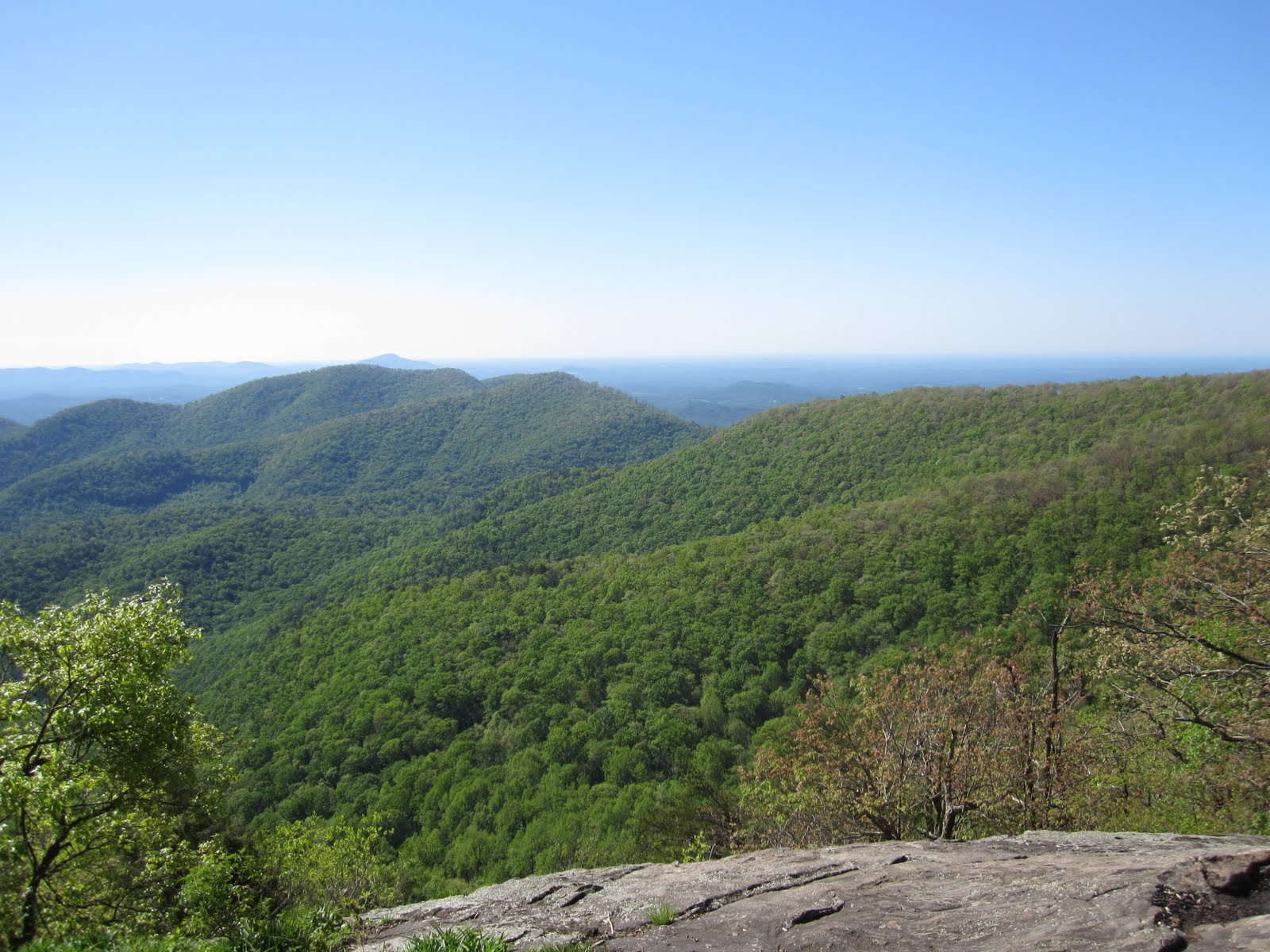
We tend to hike at a 2-mile an hour pace, so we made it over Sassafras, Justus and finally Ramrock Mountains with plenty of light left.  Ramrock Mountain offered some incredible views, before dropping us down to Woody Gap and GA-60.  We met 3 hikers on Ramrock, who were kind enough to take our pic.


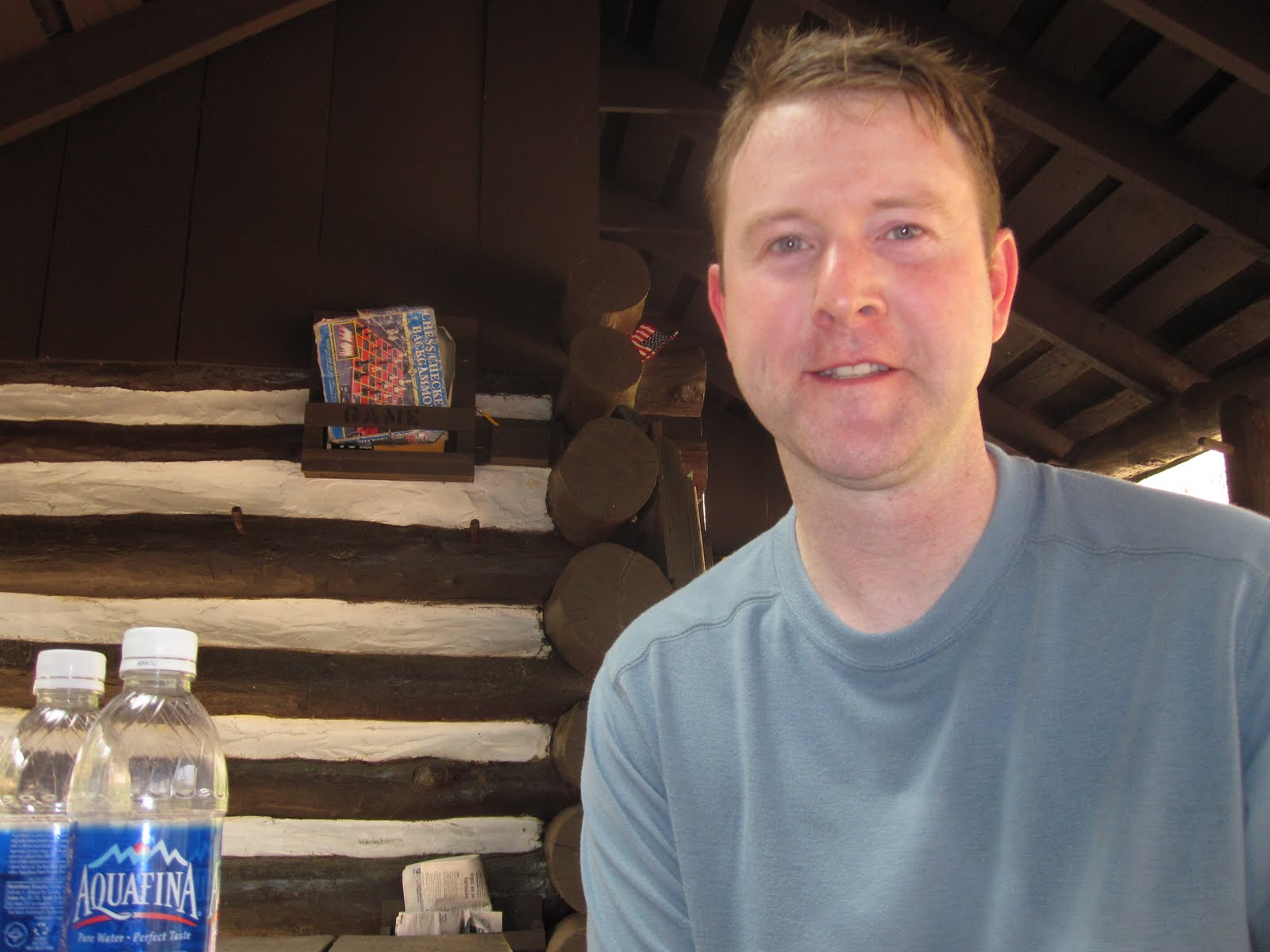
Upon reaching Woody Gap, we decided to hitch hike about 8 miles down the mountain to The Hiker Hostel.  Kyle's first hitch hiking, which he quickly commented that his mother and girlfriend would likely give him sh*t for.  No worries, I'm a seasoned hitch hiker from my days hiking with my Dad (thanks Dad for the valuable lesson!).  For $16 each we got bunks, showers, etc.  Incredible deal and a smart choice given the high temps and amount of sweat!  The owners, Josh and Leigh, thru-hiked in 2000, and were awesome hosts.  Breakfast the next morning gave us the best biscuits and gravy of the trip.


Another good day on the AT.  12.3 miles, feeling good and ready for more.  Weather forecast is sunny and 80's for the rest of our trip...surely something must be wrong?  Only blunder of the day...I lost my infamous deer hat, aka the ugliest hat in the world.

Wednesday, May 5th
Woody Gap to Neels Gap (or Neel Gap to the locals) - 10.6 miles
Miles planned for today - 10.6.  The challenge today was two big climbs - Big Cedar Mountain and Blood Mountain.  Upon arriving back at Woody Gap, my deer hat was sitting on a rock, enjoying a view from Woody Gap!  I just can't get rid of it.


The day started with a 600 foot climb up Big Cedar Mountain.  More incredible Georgia mountain views.  A hopeful thru-hiker from Chicago, Peter (aka Pedro or Sherpa), joined us on the summit of Big Cedar to enjoy the view.


The highlight of the day was Blood Mountain.  Blood Mountain is one of the most visited peaks in the South and the 6th tallest mountain in Georgia at 4,458 feet.  It is a long, gradual and rocky ascent over 1.3 miles along the AT.  In the 1500's, two Indian tribes called northern Georgia home, the Cherokee and the Creek Indians.  By the late 1600's, the two tribes were battling for resources and fought a bloody battle near Slaughter Creek on Blood Mountain.  The battle was intensely bloody, hence the name.  It is considered holy land by the Indian tribes (the Cherokee won by the way), which was the reason for a recent AT relocation several years ago around the actual site of the battle.  We drank from the cold water in Slaughter Creek, our tribute to the battle.


Reaching the top of Blood Mountain was exhausting but worth it.  At the summit, there is an old stone shelter built in 1934 by the CCC (Civilian Conservation Corp).  We had been hearing rumors of a bear that frequents this shelter, taking hiker's food bags.  Apparently the bear left a message in the shelter journal...


Plenty of views from Blood Mountain (see the link above for all of my pics).


What goes up, must come down!  After an extended break at the top of Blood Mountain, we dropped over 1,300 vertical feet over 2 miles to reach Neels Gap.  Neels Gap is 30.7 miles from Springer and the first real road crossing after leaving Springer Mountain.

Mountain Crossings, an outfitter, hostel and overall welcome sight, greets weary hikers.  We decided to spend the night in the hostel.  A few former thru-hikers, Moose and Lumpy, spent the night sharing many stories.  We didn't realize we were in Blumpkin County?  The search for the mysterious and elusive privy blumpkin continues.


Thursday, May 6th
Neels Gap to Unicoi Gap - 20.2 miles
The plan for the day was to go about 11 miles to Low Gap Shelter, but we ended up hiking the remaining 20 miles back to our car.  The day started with a nice 800 foot climb over Levelland Mountain, followed by climbs over Wolf Laurel Top, Cowrock Mountain and Wildcat Mountain.  Northern Georgia continued to treat us to non-stop views.


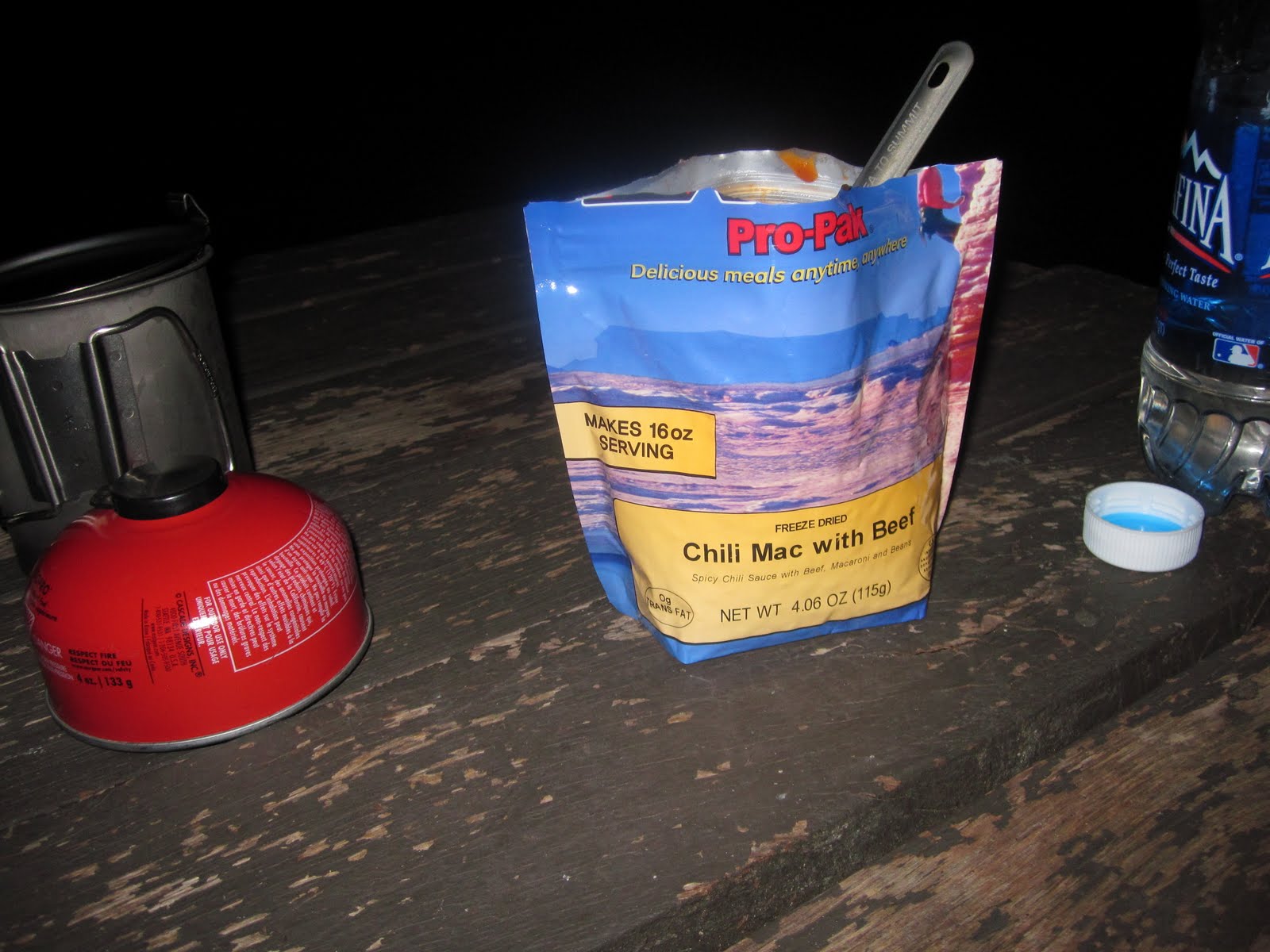
We reached our planned destination for the day, Low Gap Shelter, around 2pm.  Way too early to stop hiking, especially in good (albeit very hot) weather.  So we did what we always do...we kept hiking!  But, not after a nice break at Low Gap Shelter, including scarfing down our dinners...let's call a late lunch.  Mountainhouse Beef Stew = energy + excessive gas!


Let the fun begin.  Death march mode...on.  It's 3pm, we have 9.4 miles back to our car.  Blue Mountain stands in our way.  Of course, the AT always saves the best for last.  Even though Blue doesn't look too intimidating on the map, we are completely gassed.  8:00pm, sun about to go down, falling like two rocks off of Blue Mountain...good to see the car is still there!

An absolutely incredible section hike along some of the best that the AT has to offer.  We met tons of cool hikers (Mule, Coolbreeze, Lumpy, Peter, two brothers, etc) along the way.  That's what the AT is about, the people along the way.  The views are nice, but

We hiked 50.9 miles on some pretty rugged terrain.  That means I'm up to 102.1 miles of the Appalachian Trail officially under my belt!

Until the next time...very nice!  Leave a comment or two.  Check out the pics.  Let me know if you are ready to put on the backpack and step foot onto the Appalachian Trail!

Sunday, April 11, 2010

Caledonia State Park to Whiskey Spring Road

April 5-6, 2010
Caledonia State Park, US-30 to Whiskey Spring Road
33.1 miles hiked this section
51.2 miles total AT miles hiked

Pics from this section - Caledonia to Whiskey Spring Road


I didn't think 90 degree weather in southern Pennsylvania in early April was a possibility.  Wrong, it's possible.  My original plan was a 39-mile section hike from Caledonia State Park (where I left off my last hike) to Boiling Springs, PA.  I ended up hiking 33 miles and coming up a bit short due to the extreme heat.  33 miles in about 27 hours, fun!


I drive quite a bit for work, so I'm kind of a road warrior.  Driving long-distance isn't an issue for me.  Which is good, because it takes about 7-8 hours to get to this section of the Appalachian Trail in southern Pennsylvania.  In fact, this distance will only get greater as I hike further away from home.  Planes, trains and automobiles, whatever it takes.

Here's a fun fact...the shuttle driver I used for this section was the same guy that shuttled my Dad and I on a similar hike in this area over 15 years ago!  The same truck as well, 303,000 miles on it.

The hike started with crossing the East Branch Conococheague Creek in  Caledonia State Park.  After passing through the Park, the trail started a nice climb up to the ridge line.  420 vertical feet over a few miles, a great way to start the hike.  I arrived at Quarry Gap Shelter, a unique trail shelter in that it is overly maintained, perhaps too nice.  The shelter has a wind flap, landscaping, bench and other luxury items not normally founded in an AT shelter.  I wasn't planning to stay here tonight, so after a short break it was time to continue.


The trail through this section is some of the easier hiking found on the Appalachian Trail.  The notorious Pennsylvania rocks have not yet started and the grade is fairly easy.  There were even some sections that had a soft bed of pine needles covering the trail.  I reached Birch Run Shelters around 6:00pm.  This was my intended destination for the first day, however when I hike alone, I prefer to hike over camp.  I decided to push on another 6 or so miles to try to make it to Tom's Run Shelter.  I walked into Tom's Run right at dusk.  I had the two shelters to myself.


Dinner consisted of a dehydrated Mountainhouse meal, some water and of course, Tylenol PM.  After eating and getting cleaned up, I started looking at the next day's planned hike.  Since I hiked 6 extra miles today, I could either hike 19 miles to Alec Kennedy Shelter, or what if I hiked the entire 22.9 miles back to Boiling Springs?


Day 1 - 16.2 miles

I slept better then I've ever slept in a shelter.  Except for a few times of waking up to some sort of critters outside the shelter, I slept very well thanks due to Tylenol PM.  This will be a necessary addition on all future hikes.  Today was expected to be in the high 80's, so I had planned to get an early start.  That didn't exactly pan out as when I woke up initially at 6:30am, I was still tired and fell back asleep until 8:30am.  I packed up quickly and was on the trail by 9:00am.

After 1.5 miles, the trail detoured around Camp Michaux.  Camp Michaux was originally part of a farm associated with the iron making operation at Pine Grove Furnace.  The farm became a Civilian Conservation Corp camp in the 1930's and was finally used as a Prisoner of War camp for German POW's in World War II.  Most of the buildings are gone, with the exception of a stone wall and foundation.  The AT travels through many historic areas.  In fact, Gettysburg is only 20 miles from this area.  Many of the hills and trails I walk over were used by troops in the Civil War.


By mid-morning I made it to Pine Grove Furnace State Park.  This park is infamous along the AT and serves as a kind of halfway point for thru-hikers (Pine Grove is located near the actual AT mid-point).  It is also home of the Half Gallon Challenge, where thru-hikers are challenged to eat a 1/2 gallon of ice cream of their choosing within 1/2 hour.  Unfortunately for me, the General Store wasn't open today, so my challenge would have to wait.  I did however enjoy walking through this historic park and seeing some of the same sights that my Dad and I saw 15+ years ago on a hike through this area.


After making it to Whiskey Spring Road I decided to hitch a ride back to my car in Boiling Springs.  What an incredible section of the AT.  I plan to hike another section in PA in the Fall, picking up where I left off.


Day 2- 16.9 miles
Total Section Miles - 33.1 miles
Total AT Miles - 51.2 miles


Next hike up - Springer Mountain in Georgia in early May.  I am planning a 5-day hike starting at the southern terminus of the Appalachian Trail in Georgia.


Thursday, December 31, 2009

Pen Mar Park to Caledonia State Park

December 28-29th, 2009
Pen Mar Park, MD to Caledonia State Park, PA
18.1 miles


AT Hike #1 - Pen Mar to Caledonia - Dec 2009
Click above for pictures from my first section hike.

Before I begin, one of the biggest challenges I will face is logistics. Driving several hours to get to the trailhead. Arranging for a shuttle service to take me from where I park my car and where I plan to end each section, to where I begin each section. There is also the gear issue. It takes a ton of planning to get your gear ready for each section hike, not to mention the sheer amount of "stuff" that is needed on each hike.

Here is a partial list of what I took on my winter section hike from Pen Mar to Caledonia:

Backpack, 20 degree sleeping bag, sleeping pad, backpacking stove/fuel/pot, water treatment drops, clothing to stay warm down in winter, gaiters, hiking poles, balaclava, yaktrax, rain gear, first aid/survival kit, camera, maps (I actually forgot my maps!), sunscreen, chapstick, knife, headlamp...etc.

I left Michigan around 4am on December 28th and got to Caledonia State Park in Pennsylvania around 12:30pm. My shuttle service (thanks Bill and Amy!) picked me up around 1pm and dropped me off at Pen Mar Park, just over the PA/MD border. I started heading north at 1:30pm, temperature hovering around 25 degrees with a solid 15-20 mile an hour wind. It was cold! First rule in winter hiking is to keep moving if you want to stay warm. Second rule is don't sweat! Sweat and cold is not a fun combo and can lead to hypothermia. The key is to layer as much as possible to make it easy to regulate your body heat as you are hiking.


The hike started off perfectly. A nice climb to help get warm plus the sun was out all day. Couldn't ask for better weather in late December in Pennsylvania. This part of the AT is close to civilization, so there are many road crossings and views of nearby towns. After crossing several roads and at mile 4.9, I reached Deer Lick Shelters for a break. For those not familiar with the Appalachian Trail, there are three-sided, elevated shelters or huts every 8-12 miles along the trail. They offer refuge from the weather and a warm place to sleep. They are very rustic, frequented by trapeeze-artist mice, snoring hikers, yet also help create a sense of community along the trail.


Let's talk about food. I usually keep a Clif bar or Snickers in my pocket to eat while hiking, but when I take an extended rest break, I like to eat something that will provide good energy for my next segment. Mini bagels and peanut butter, trail mix are favorites. Peanut butter is energy food while hiking. Breakfast usually consists of coffee and a Poptart or maybe a breakfast bar. Dinner is usually a freeze-dried Mountainhouse meal. Also, water is obviously key. I typically carry two Aquafina liter water bottles.  They are durable and easy to refill. I get water from streams and springs along the trail and use a chemical treatment to purify my drinking water.

After a nice break at Deer Lick Shelters, I realized that I only had an hour and a half until the sun went down. Winter hiking is unique in that it is dark by 5pm. I picked up my pace and after hiking through a road-side park, reached my destination for the night, Tumbling Run Shelters. These are two very nice shelters, one for snoring and one for non-snoring (I was in the snoring one), about 0.2 miles off a road and next to a stream or run. I normally don't like to stay in shelters so close to a road, but it was a Monday night and the temperature was in the 20's. I had the shelters to myself, which wasn't unexpected given the weather. Day 1 - 8.5 miles.


Again, the most unique part of winter hiking, especially solo winter hiking, is the amount of dark down-time. It starts getting dark at 5pm and by 6pm it is completely dark. I quickly set up my sleeping bag and got my geared organized for a long, cold night. My bag is rated to 20 degrees, but I'm a cold sleeper. I ended up wearing three layers on top and bottom, down booties, my balaclava and wool hat. I didn't want to go to sleep at 6pm, even though I was tired, so I watched Bruno on my iPod. I'm sure that has to be a first! I texted Kelly (my wife) a few times to let her know I was warm, safe and on pace to finish up tomorrow. She also was kind enough to relay my elevation profile for the next day's hike since I had forgotten my maps at home! I also read for about an hour, but finally got too cold to keep even my arms outside my sleeping bag.

I was warm enough to get some sleep and surprisingly felt well rested the next morning when I got up around 8am. The day started with packing up while still mostly in my sleeping bag. I changed clothes, brewed some coffee (Starbucks instant single serve coffee rocks) and ate a quick breakfast. Finally I had to get out of my bag to finish packing up and that was when I hit my coldest for this trip. I was like a walking, talking science experiment. What happens when the body gets cold? Well, the answer is your heart directs blood to your core organs first, leaving you extremities to fend for themselves. In other words, my feet and hands were completely numb. Makes packing up interested! The solution? Start hiking, and at a brisk pace! After 30 minutes, everything was back to being warm, more or less.

Day 2 started off with a nice climb up to Chimney Rocks (see the link above for my pics). This is a large rock formation on top of Buzzard Peak. It offered incredible views and was a perfect way to start the day. After snapping some pics, the cold wind forced me to move on. The rest of my day consisted of some nice ridge walking, although exposed to the cold winds, and finally a descent to US-30 and Caledonia State Park, the end of this section hike. Day 2 - 9.6 miles.


Total miles hiked on this section - 18.1 (0.83% of the AT!)

Lessons learned:
  1. Yaktrax are good on snow and ice, but can't hold up to PA rocks.
  2. Watching Bruno on an iPod in a trail shelter is a fun way to spend a cold night.
  3. Need a warmer sleeping bag for future winter hikes.
  4. Down booties might not look manly, but they keep your feet warm!
  5. Balaclavas give you awesome bed head hair in the morning.
  6. No journey worth taking is easy.
Until next time...

Sunday, December 27, 2009

And so it begins...

Well, sort of. The truth is I have been hiking the Appalachian Trail, or the AT, since I was a teenager. I've decided to hit the reset button and start section hiking the entire 2,178-mile Appalachian Trail. I am a section hiker. The window for thru hiking has closed for me, but I am able to get away for 3 to 5 days at a time, several times each year (I have an awesome wife!).

My goal is to section hike the AT over the next 20 or so years. It's a long-term goal! A lesson in patience and perseverance, both are qualities that I have room for improvement!

A little background on the Appalachian Trail, for those who are not familiar with the footpath. The "AT" is a 2,178-mile linear trail, starting in northern Georgia (Springer Mountain) and ending in Maine (Mt. Katahdin). The trail covers all types of terrain and passes through very remote areas and populated areas. There are high peaks in Tennessee and North Carolina, as well as low areas in the Mid-Atlantic states.

The trail is known for its "thru-hikers", those who attempt to hike the entire trail in one shot, typically starting in early spring and ending in fall. The success rate for thru-hikers is estimated at less than 20%. Most hikers hike NOBO, or northbound, however some prefer the solitude of a SOBO, southbound, journey. Either way, the AT is really about the people hiking it, maintaining it and supporting it in nearby towns.

And so it begins. I welcome you to follow me on my journey. I can't do it alone. I will need the support of my wife, family and friends to hold down the home front and provide motivation, my co-workers to hold down the office, the shuttle drivers to help me get from point A to B, my fellow hikers to provide company along the way and perfect strangers to help out when I least expect it.

My first trip will be over the 2009 holidays!